
Latest News
Rancabuaya Ground Survey - part 1.
We were conducting Rancabuaya ground survey on February 8 until 10, 2005. The route of the survey
is as follows: Bandung - Pangalengan - Rancabuaya - Cidaun - Pameungpeuk - Cikajang - Garut -
Leles - Cipanas - Samarang - Majalaya - and back to Bandung again. The new south ring road has to
be put into GPS coordinate, that is the reason why the survey has to be done. The team consists of:
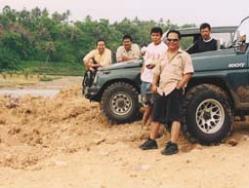
Adjat Sudradjat, Joko A. Mulyono, Iwan Nursalam, Ady Ruchiatan, and Endang. Besides that, we were
also taking pictures of beautiful places to be used as a promotion to the Indonesian Board of Tourism.
is as follows: Bandung - Pangalengan - Rancabuaya - Cidaun - Pameungpeuk - Cikajang - Garut -
Leles - Cipanas - Samarang - Majalaya - and back to Bandung again. The new south ring road has to
be put into GPS coordinate, that is the reason why the survey has to be done. The team consists of:
Adjat Sudradjat, Joko A. Mulyono, Iwan Nursalam, Ady Ruchiatan, and Endang. Besides that, we were
also taking pictures of beautiful places to be used as a promotion to the Indonesian Board of Tourism.
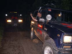
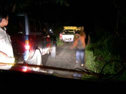
| In Pangalengan, we had to winch the truck fully loaded with woods because the truck was stuck in the middle of the road. |
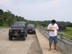
| Joko Asto did GPS measurement on one of the bridges. |
| Taking picture in Cidaun. |
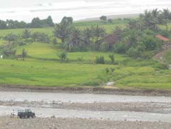
| Look how small our car is. |
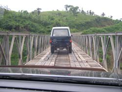
| Crossing the bridge. |

| PT. NUSANTARA AGUNG RAYA CONSULTANT "Where you can find the best Mapping, Surveying, and GIS" |


| |
| |
| |
| |
| |
| |
| Links | FAQs | Latest News | Testimonials | Photo Gallery | Career |
| | Home | About Us | Contact Us | Services | Products | Management | Partners | | Links | FAQs | Latest News | Testimonials | Photo Gallery | Career | All texts and images appear on this Website are courtesy of PT. NARCON and its affiliates. All rights reserved. No reproductions and use are permitted without PT. NARCON's authorization. Copy rights of PT. NARCON since 1973. |